Google Maps Adds Feature That Will Tell You About The Number Of COVID-19 Cases In A Location
Coronavirus is now more than 10 months old with people still awaiting a vaccine that would ward it away. However, until there is no vaccine in sight we’re all adopting social-distancing and wearing face masks to keep us safe.

But what if you could get a warning about the number of coronavirus cases in so and so spots? At least it would be a relief for our moms who are eternally calling us reminding us to wear the mask. Ahh!! you know what I’m talking about.

Well, thankfully Google has got us covered.
Also Read: Tamed Elephants In India To Soon Get ‘Aadhaar Cards’ Based On Their DNA
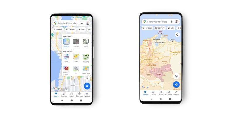
Google has added a new feature to Google Maps dubbed COVID Layer. The same, as per Google, will show users information of COVID-19 cases in a particular area so one can plan their errand accordingly.

The feature draws data from sources like John Hopkins Institute, New York Times and even Wikipedia. Also, additional information organisations like WHO, government health ministries as well as state and local health agencies.

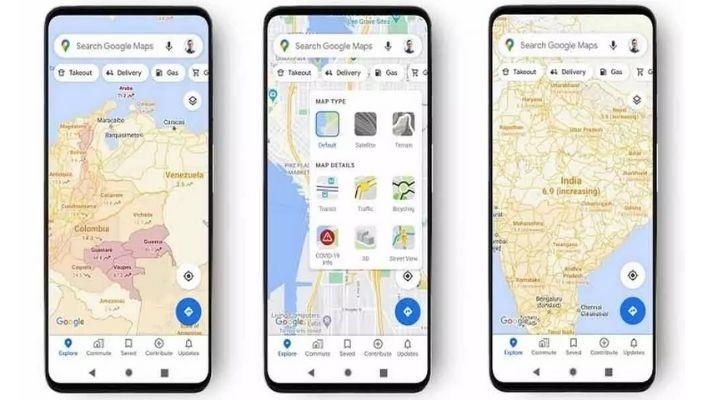
To enable the feature, go to Google Maps, tap on ‘layers’ button on the top right-hand corner. Next, from the options, simply tap on ‘COVID-19 Info’. And done!!
Also Read: 16 Artistic Best Of Nature That You’d Wish You Had Seen In Real Life
The colour of a particular area on Google Maps where there are COVID cases will change as per the severity of the cases in the area.

Also Read: Delete Your WhatsApp Messages Right Now Because Apparently, Navika Can Read Them All
According to Sujoy Banerjee, Product Manager, Google Maps, “You’ll then see a seven-day average of new COVID cases per 100,000 people for the area of the map you’re looking at, and a label that indicates whether the cases are trending up or down.”


